Urban Tree Shade Model

Presenters:
Yifan Yang
University of Southern California
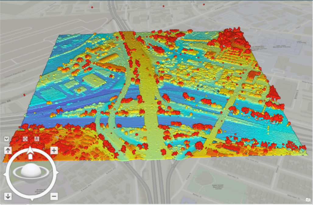
Urban forest is a critical green infrastructure that not only enhances the aesthetic of the environment but also positively influences urban climate conditions and the well-being of residents. Specifically, the urban tree shade mitigates land surface temperature and lowers energy consumption that becomes more important in the changing climate. This project aims to prototype a 3D shade model and assess the shade coverage provided by urban trees in Boyle Heights neighborhood in City of Los Angeles as the test bed. This prototype leverages advanced Geographic Information System (GIS) technology and high-resolution LiDAR data to accurately map and build 3D models of the terrain and surface features. Our findings highlight the measurable significance of urban tree shade in the complicated urban setting. The prototype is a scalable and replicable method that can be used to identify the most shadeless area and support the scenarios comparison and decision making in city’s urban greening programs.