Tree Species Detection on Campus

Presenters:
Wanxin Li
Kuan Hsein Lin
University of Southern California
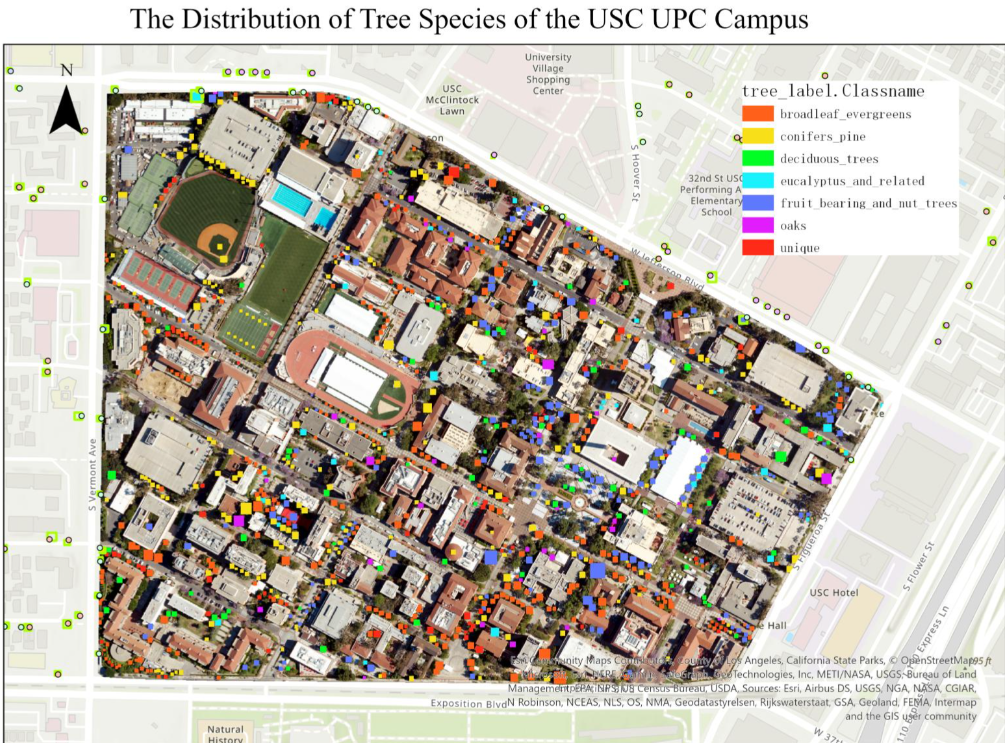
This proposal describes a project to develop an ArcGIS StoryMap, using remote sensing and machine learning techniques to identify tree species in Los Angeles and their role in mitigating urban heat islands. The project aims to assess how different tree species impact urban cooling, an important consideration as urban temperatures rise due to urbanization. We will use high-resolution multispectral images, combined with machine learning and deep learning algorithms, for accurate tree species identification. The data will be validated through field surveys in select areas and by using the LA Tree Dataset. The resulting StoryMap will show the distribution of tree species across the city and their influence on urban heat patterns. This project aims to provide city planners and the public with insights into effective urban greening strategies to counter heat islands, blending technology with environmental management for urban ecological sustainability.