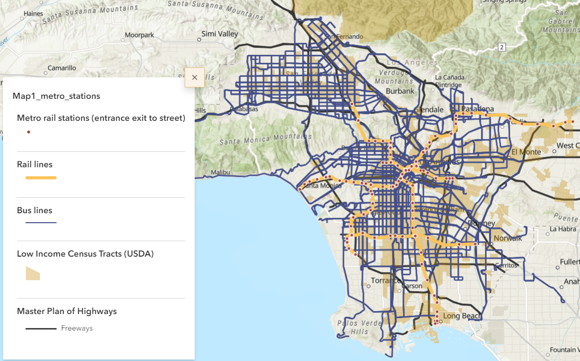
Transit as Public Good: How far are we from a competitive transit system in fostering everyday mobility in Los Angeles County?

Presenters:
Mengya Xu
University of Southern California
A healthy diet, essential in protecting against chronic diseases like obesity and diabetes, depends in part on people’s access to healthy foods. Traditional assessments of food environments, centered on the “food desert” concept, often miss the nuances of people’s travel patterns, shopping behaviors, and transportation methods and are subject to data biases in food datasets and definitions. Furthermore, the reliance on census tracts to define neighborhoods can misrepresent the dynamic nature of neighborhoods as experienced in real life.
This study adopts an analytical framework combining socio-ecological models, social determinants of health theory, the urban planning philosophy of the 15-minute city, and an activity space perspective supported by GPS-based mobility data and GIS analytics. We map households faced with barriers to healthy foods and investigate variations in access based on available transportation modes (public transit, walking, and driving) and different times (i.e., rush hour vs non-rush hour). Additionally, the impact of data sources and classification variability of food outlet constructs on food environment measures is discussed. Our findings and methodologies offer urban planners and policymakers a practical tool to evaluate grocery access in diverse communities more effectively and contribute to the development of targeted interventions for improving food access.