Lidar-Based Tree Classification and Feature Extraction

Presenters:
Camryn Gonzalez Ching
Iris Flores
Julie Lazor
California State University, Long Beach
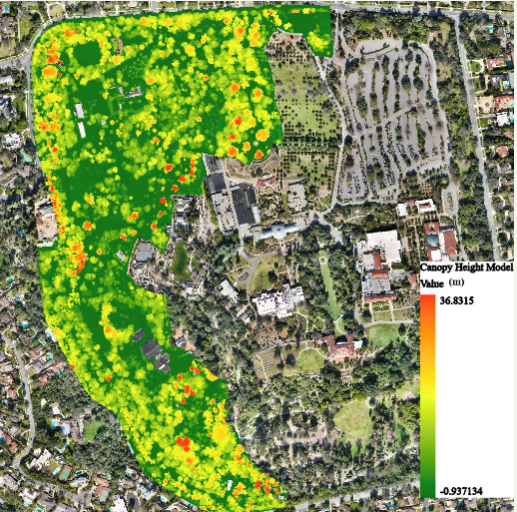
The Huntington Library, Art Gallery, and Botanical Garden, a non-profit institution,
spans 200 acres and houses diverse plant species. To efficiently manage this extensive botanical
collection, Geographic Information System (GIS) is employed for inventory purposes. While previous surveys identified and georeferenced many species, a significant portion, particularly densely populated trees, remains unsurveyed. This project utilizes lidar technology to create a 3D model of the unsurveyed area, employing ArcGIS Pro and Deep Learning Techniques for analysis. Three classification methods—Surface Analysis, Cluster Analysis, and Raster to Point/Polygon Feature Analysis—are tested to extract tree points and measure height, canopy width, and tree count. The objective is to construct an interactive 3D map for efficient garden management and long-term species tracking. Additionally, the study evaluates lidar data classification techniques for vegetation attributes, comparing outcomes to identify the most accurate and reliable tool. The findings contribute to advancing lidar data processing and analysis techniques, informing future vegetation assessment studies and aiding researchers and practitioners in selecting effective tools for precise information extraction from lidar data in the Huntington Library and Botanical Garden.